Fanny Bernard
BC Wildfire Service
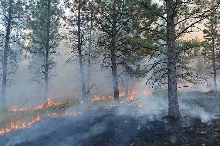
With the hot summer months finally winding down, BC Wildfire Service crews can now focus their efforts on the proactive burning of selected areas in accordance with the long-term plan of enhancing native plant and animal life as well as creating conditions for more fire-resilient communities.
Historically, the Rocky Mountain Trench was an open valley bottom with very few trees present. Naturally-occurring low-intensity fires burned every five to seven years in the valley bottom, while more intense fires burned at about 20-year intervals at higher elevations.
Since the absence of wildfires in recent decades, many areas have become overgrown and no longer represent the natural attributes of this unique biological zone. By increasing canopy openings, controlled burns enhance plant habitat by allowing more areas to be exposed to sunlight and precipitation. Once native plants repopulate the area, many animal species such as mule deer, elk and sheep once again use these areas as foraging grounds.
The benefits of these planned ecosystem restoration burns are many, and include the improvement and rejuvenation of winter ranges for elk, deer and sheep. Reintroducing fire to this fire-dependant ecosystem ensures targeted trees will thrive while biodiversity is enhanced across the landscape. Low-to-moderate intensity prescribed fire also returns the area to its natural state.
In addition to the important role wildfire plays in maintaining biodiversity, its role in protecting communities from catastrophic wildfires cannot be overstated. This past summer alone, previously burned areas were a significant factor in the suppression of two interface fires within the Southeast Fire Centre.
The 21,823-hectare Stickpin Fire, which grew quickly towards Canada on August 13th and 14th due to strong and gusty southerly winds, was considerably slowed by the lack of available fuel once it reached the previously burned-out area.
Several of these prescribed ecosystem restoration projects are now awaiting suitable weather conditions in the East Kootenay area. Prescribed burns are only ignited when weather conditions are favorable and when the fire will not create excessive smoke. This is determined by carefully studying the venting index, temperature, humidity and wind conditions. The venting index is a measure of how quickly smoke will disperse under specific conditions. Every effort will be made to notify the public as to the exact dates these burns will take place.
All prescribed burns must comply with the Environmental Management Act and the Open Burning Smoke Control Regulation. A prescribed burn is ignited and continuously monitored by trained firefighting crews to ensure the fire stays within established containment lines. In order to replicate the natural process of fire on the landscape, fires are allowed to self-extinguish, thus consuming the accumulated fuels.
For up-to-date information on the wildfire situation in B.C., please visit bcwildfire.ca.
The geographic locations of the prescribed ecosystem restoration burns planned for the East Kootenay are as follows:
• Raymond and Donald Creek — These areas, totalling 450 hectares in size, are located in the Galton Range. Smoke from this prescribed burn will be highly visible from Highway 93 and the communities of Jaffray, Baynes Lake, Koocanusa and Elko. Once ignited, this area will be allowed to burn, under supervision, until the winter.
• Wolf Creek — This 250-hectare planned burn is above Quartz Lake, in the Premier Provincial Park. Smoke will be visible from Wasa Lake and Highways 93 and 95.
• Estella Face — This 150-hectare area is south of Lazy Lake. Its smoke will be visible from several areas, including Wasa, Highways 93 and 95 and Ta Ta Creek.
• Burn Bottom — This 380-hectare scheduled burn is adjacent to the community of Kragmont, just outside of Baynes Lake. There has been previous slashing work done to this area. Smoke from this project will be visible from Highway 93 and the communities of Baynes Lake, Jaffray, Elko and surrounding areas.